



Parc naturel d’Irving

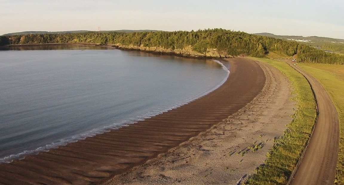
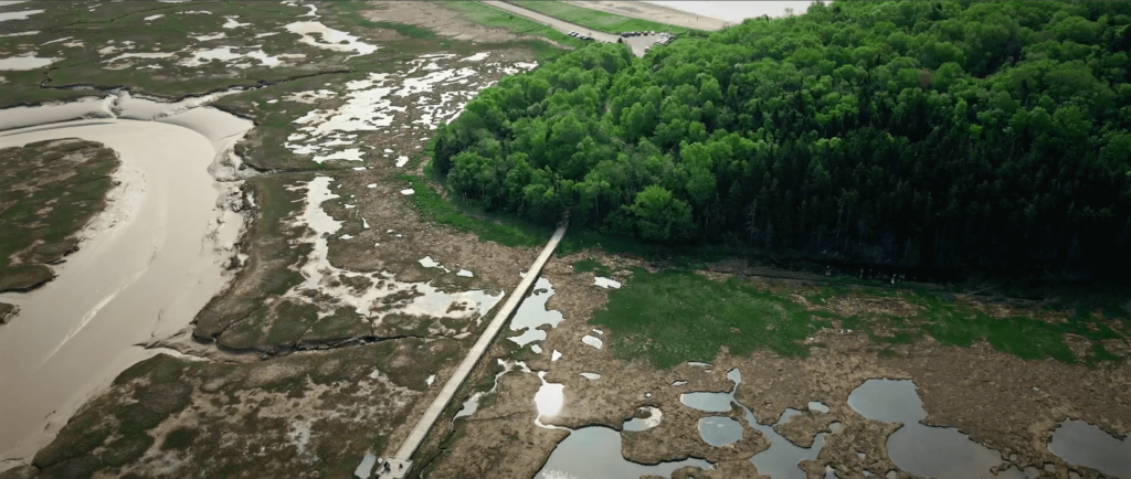
Le parc naturel Irving est un espace naturel situé à l’ouest de Saint John. Il comprend une route pour ceux qui souhaitent traverser le parc en auto, ainsi que d’innombrables sentiers de randonnée, des belvédères, des plages et une promenade en planches traversant le marais salé. On y trouve également une forêt pour enfants avec un labyrinthe et une superbe aire de jeux.
Comment s’y rendre
Prenez la sortie 119A de l’autoroute 1 en direction de la rue Bleury. À l’intersection, tournez à droite sur le chemin Sand Cove. Suivez cette route jusqu’au parc. Il y a un sentier de sable que vous pouvez emprunter pour rejoindre le stationnement principal et même poursuivre votre trajet en voiture à travers le parc!
Géologie
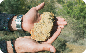
La géologie du parc naturel Irving comprend à la fois des roches en place datant du Dévonien au Carbonifère (âgées de 359 à 346 millions d’années), affleurant sur l’île Taylors et à Sheldon Point, et des couches superposées de sable, de gravier et d’argile déposées au cours de la dernière période glaciaire, il y a moins de 15 000 ans. L’âge des roches volcaniques et sédimentaires plus anciennes a été difficile à déterminer.
Bien qu’elles présentent de nombreuses caractéristiques intéressantes, cette note se concentrera sur la géologie de l’ère glaciaire du parc naturel Irving. C’est l’un des meilleurs endroits de Stonehammer pour observer cette partie de l’histoire géologique. La géologie de l’ère glaciaire est constituée de sédiments « non consolidés ». Ce ne sont pas encore des roches, elles sont trop jeunes.
La fin de la période glaciaire a été marquée par des changements climatiques rapides, en particulier pendant la période de refroidissement connue sous le nom de « Younger Dryas ». Il y a environ 11 000 ans, les températures ont chuté d’environ 7 °C en l’espace d’une décennie. Des insectes subarctiques ont réinvesti les Maritimes pendant des centaines d’années, jusqu’à ce que les températures remontent. Une tourbière située sur la colline de la plage de Saints Rest témoigne de cet événement climatique soudain.
À une époque que les géologues appellent le « dernier maximum glaciaire », il y a environ 20 000 ans, les glaciers continentaux recouvraient la majeure partie de l’Amérique du Nord, y compris les Provinces maritimes. Il y a 10 000 ans, le Nouveau-Brunswick était probablement « libre de glace ». En se retirant, les glaciers ont laissé des amas de sable et de gravier le long de leurs marges. Appelés « moraines » et « dépôts de dégel », ces amas de sédiments sont facilement visibles dans le paysage actuel. Nous les exploitons souvent comme carrières de sable et de gravier. La carrière située sur le chemin Sand Cove, au-dessus de la plage, en est un exemple. Il y a environ 15 000 ans, le front du glacier se trouvait ici, au parc naturel Irving. On parle de « glacier de marée », car la glace du glacier était en contact direct avec l’océan. L’argile rouge le long des falaises de la plage est composée de couches de sédiments océaniques.
On trouve parfois dans l’argile des fossiles d’escargots, de palourdes, d’oursins et d’étoiles de mer. À mesure que le glacier continuait de reculer, il a laissé derrière lui une série de moraines aux endroits où il s’était immobilisé pendant un certain temps. En regardant vers le nord-ouest depuis la plage, on peut apercevoir la route Manawagonish sur la colline. Cette route est construite sur la moraine de Manawagonish. Cette moraine a agi comme un barrage et a forcé la rivière Saint-Jean à s’écouler par les chutes Reversing.
Histoire
Le paysage naturel du parc naturel Irving est spectaculaire. Le marais Saints Rest a toutefois une histoire complexe. Endigué par les Acadiens entre 1786 et 1864, le marais a d’abord été exploité principalement pour le pâturage et la production de foin. Des granges ont été construites dans le marais, des routes l’ont traversé, et des activités forestières ainsi que l’extraction de gravier ont eu lieu sur les terres hautes et la plage adjacentes. Peu avant la Seconde Guerre mondiale, le marais a été considérablement modifié pour servir de champ de tir militaire. Son abandon dans les années 1950 a entraîné la détérioration de la digue, qui a fini par céder. Aujourd’hui, Saints Rest, le plus grand marais salé de Saint John, fait partie du parc naturel Irving.